Bender (Bender)
 |
 |
Together with its suburb Proteagailovca, the city forms a municipality, which is separate from Transnistria (as an administrative unit of Moldova) according to Moldovan law. Bender is located in the buffer zone established at the end of the 1992 War of Transnistria. While the Joint Control Commission has overriding powers in the city, Transnistria has de facto administrative control.
The fortress of Tighina was one of the important historic fortresses of the Principality of Moldova until 1812.
First mentioned in 1408 as Tyagyanyakyacha (Тягянякяча) in a document in Old Slavonic (the term has Cuman origins ), the town was known in the Middle Ages as Tighina in Romanian from Moldavian sources and later as Bender in Ottoman sources. The fortress and the city were called Bender for most of the time they were a rayah of the Ottomans (1538–1812), and during most of the time they belonged to the Russian Empire (1828–1917). They were known as Tighina (Тигина, ) in the Principality of Moldavia, in the early part of the Russian Empire period (1812–1828), and during the time the city belonged to Romania (1918–1940; 1941–1944).
The city is part of the historical region of Bessarabia. During the Soviet period the city was known in the Moldavian SSR as Bender in Romanian, written Бендер with the Cyrillic alphabet, as Bendery (Бендéры) in Russian and Bendery (Бенде́ри) in Ukrainian. Today the city is officially named Bender, but both Bender and Tighina are in use.
Map - Bender (Bender)
Map


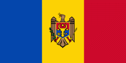
Country - Moldova
 |
 |
| Flag of Moldova | |
Most of Moldovan territory was a part of the Principality of Moldavia from the 14th century until 1812, when it was ceded to the Russian Empire by the Ottoman Empire (to which Moldavia was a vassal state) and became known as Bessarabia. In 1856, southern Bessarabia was returned to Moldavia, which three years later united with Wallachia to form Romania, but Russian rule was restored over the whole of the region in 1878. During the 1917 Russian Revolution, Bessarabia briefly became an autonomous state within the Russian Republic. In February 1918, it declared independence and then integrated into Romania later that year following a vote of its assembly. The decision was disputed by Soviet Russia, which in 1924 established, within the Ukrainian SSR, a so-called Moldavian autonomous republic on partially Moldovan-inhabited territories to the east of Bessarabia.
Currency / Language
| ISO | Currency | Symbol | Significant figures |
|---|---|---|---|
| MDL | Moldovan leu | L | 2 |
| ISO | Language |
|---|---|
| RO | Romanian language |
| RU | Russian language |
| TR | Turkish language |